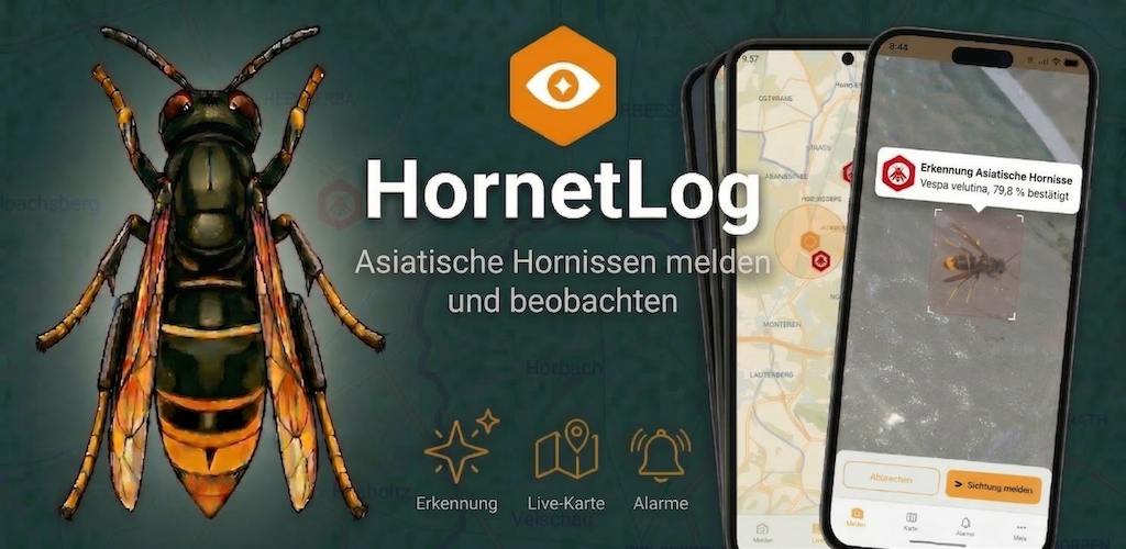
The Asian hornet is spreading further and further across Europe. That makes it all the more important to report sightings early. But how can you report an Asian hornet and at the same time contribute to a better data basis?
In recent years the Asian hornet (Vespa velutina) has spread rapidly in many parts of Europe. Originally introduced by accident, the invasive species has now become established in several countries and poses a challenge for beekeepers, nature conservation and public authorities.
For effective monitoring, one thing matters above all: detecting and documenting sightings early.
Many observations, however, are not made as part of official monitoring programs, but by people who come across the hornet by chance – beekeepers, walkers, garden owners or nature watchers.
This is where a simple question comes in:
How can technology help make it easier to report an Asian hornet and to evaluate the reports better?
That is exactly the question I have been working on for a few months in a small side project.
How can you report an Asian hornet?
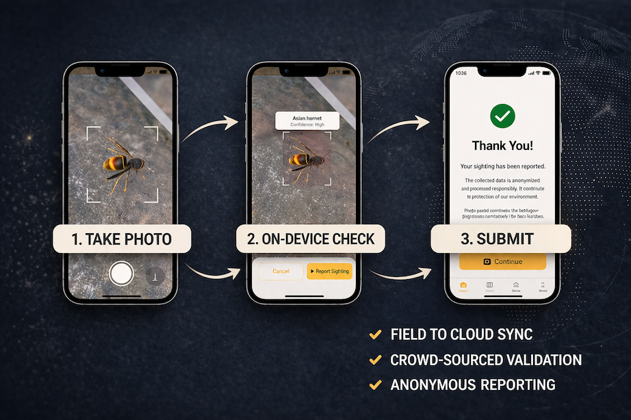
At the heart of the project is a mobile app that lets you report sightings of the Asian hornet right in the field.
Instead of filling in complicated forms, users can simply take a photo of the insect and submit the observation together with location information.
The app is meant to help report an Asian hornet quickly and easily while capturing structured data at the same time.
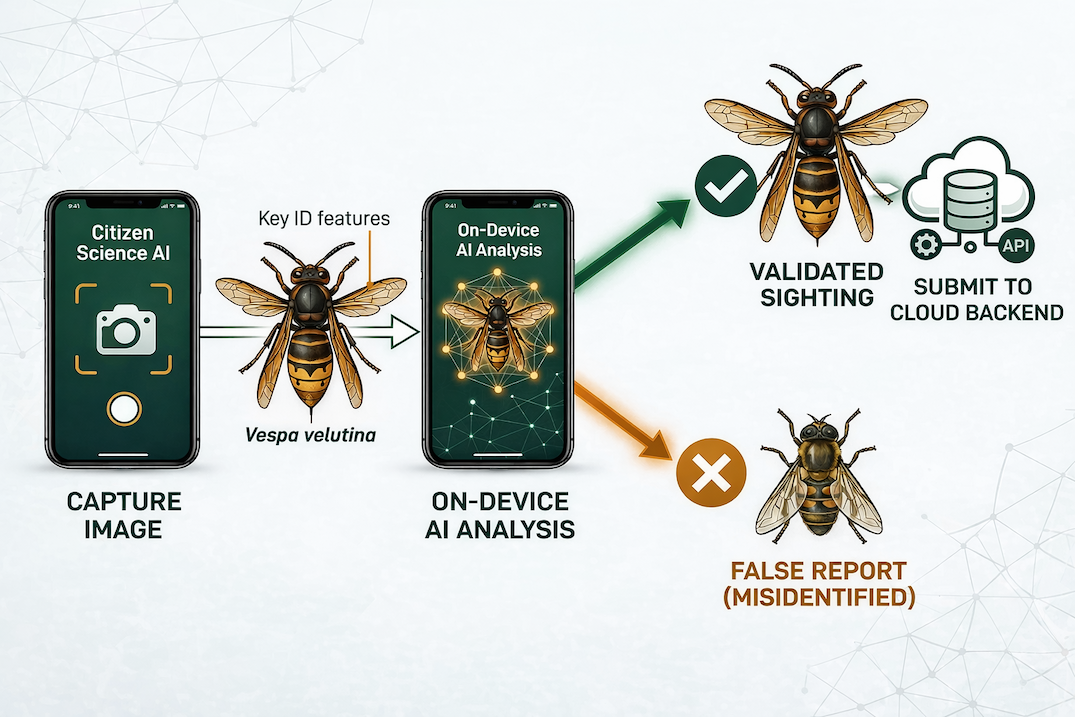
To improve the quality of the reports, the image is analyzed right on the device by a small AI model. This provides a first assessment of whether it might be Vespa velutina.
This automatic analysis does not replace confirmation by an expert, but it can help reduce obvious false reports and improve the quality of the data.
Once the photo has been taken, the sighting can be sent, together with time and location information, to a cloud platform where the data is stored and processed further.
Citizen science as the basis for better data
A central idea behind the project is the citizen science approach.
Many people observe their surroundings very closely – especially beekeepers, nature lovers or garden owners. With invasive species in particular, such observations can provide valuable clues.
The easier it becomes to report an Asian hornet, the better the data basis gets.
When sightings are recorded in a structured way, a body of data builds up over time that can help us better understand the spread of the Asian hornet.
An easily accessible reporting system can help collect more observations and achieve better spatial coverage at the same time.
AI-assisted support for identification
An experimental part of the project is the use of computer vision models to support identification.
Over the course of the project, various object detection models were trained and tested to see whether Vespa velutina can be reliably distinguished from similar species.
The aim was not so much to have an AI deliver a final identification, but rather to make a first automatic assessment possible.
Such models can help support the reporting process and improve the quality of the incoming data.
A scalable platform for sighting data
In addition to the mobile app, the project also includes a backend platform that processes and stores the reported sightings.
Even though the project started out as a small experiment, the infrastructure was designed so that it can, in principle, cope with growing amounts of data.
Among other things, the platform takes care of:
- Storing sighting data and metadata
- Processing uploaded images
- Providing interfaces for the app
- Visualizing observations on maps
Citizen science projects in particular can see strong fluctuations in usage, for example during the hornets’ peak activity period in summer.
A flexible infrastructure helps absorb such load peaks.
Maps and geodata for analyzing the spread
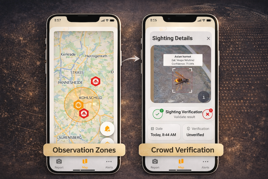
An important part of the project is the visualization of sightings on maps.
Geodata makes it possible to recognize spatial patterns and to observe the spread of the species across larger regions.
For this, a map infrastructure is used that relies on vector map tiles and is designed to deliver geodata efficiently.
Various caching mechanisms allow map requests to be served efficiently and reduce server load.
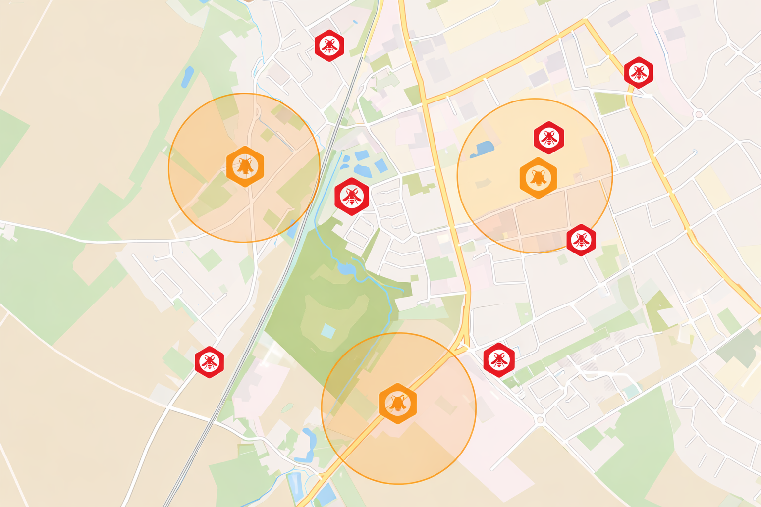
Recognizing patterns: clusters of sightings
As the data basis grows, interesting spatial patterns can emerge.
When several sightings occur in a particular area, so-called clusters can form.
Such accumulations of reports can indicate increased activity in a region and may point to a nest nearby.
Analyses like these do not replace the work of experts, but they can provide additional clues.
Combining with environmental and contextual data
Besides the sighting data itself, further contextual information could also be included in the future.
This includes, for example:
- Weather data
- Landscape structure
- topographic information
Combining such data with observations could, in the long run, lead to a better understanding of how and why the Asian hornet spreads in certain regions.
An ongoing experiment
The project is still at an early stage and came about primarily as a technical experiment.
It brings together several exciting fields:
- Citizen science
- Biodiversity monitoring
- Computer vision and machine learning
- mobile applications
- Geodata and map infrastructure
A first pilot phase is currently being prepared, which will initially start at a local level.
The goal is to make reporting the Asian hornet accessible and easy for everyone.
It will be exciting to see whether the combination of modern technology, AI and public participation can yield new insights into the spread of Vespa velutina.
More information about the project and the planned app is available at https://hornet-log.app.